.svg)

.png)

Goal
As part of a broader initiative to improve site safety and mitigate unauthorized access around key public infrastructure, our firm was mandated to perform high-precision as-built scans of the newly constructed REM station in Saint-Bruno. The client required detailed architectural documentation of the site conditions in order to develop effective perimeter fence strategies. These fences are intended to prevent pedestrian trespassing and restrict access to high-risk zones along the station's edge. By delivering an accurate digital record of the existing layout, our scans served as a critical design and planning tool to support the implementation of targeted safety measures across the site.
Method
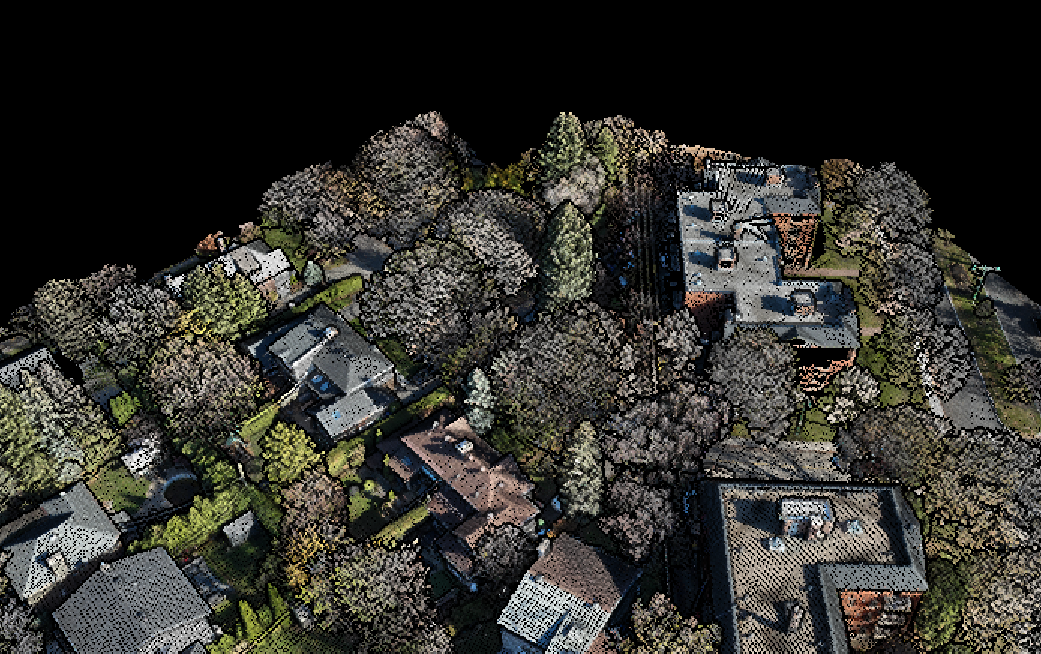
To accurately capture the complex terrain and built conditions surrounding the REM station in Saint-Bruno, our field team deployed the Trimble X9 3D laser scanner—a high-performance terrestrial LiDAR system designed for precision and reliability in outdoor environments. The X9 uses advanced laser scanning technology to rapidly capture millions of data points, generating a dense and georeferenced point cloud that faithfully reflects both topography and built elements in high detail.
The resulting point cloud served as a foundational asset for the project, offering an exceptionally accurate spatial record of the station’s perimeter and elevation profiles. This allowed our team to integrate real-world site conditions directly into architectural presentation drawings, underlaying the scanned data within proposed fence layouts and elevation studies. The clarity and precision of the point cloud made it possible for the client to clearly visualize each proposed intervention in context—enhancing both the design process and decision-making for future safety improvements.
Conclusion
The REM St-Bruno station scan highlights the powerful capabilities of the Trimble X9 for surveys involving complex terrain and existing infrastructure constraints. Its ability to capture high-density, highly accurate data at a human scale made it the ideal tool for this safety-focused intervention. The clarity and precision of the point cloud allowed both the client and collaborating architects to confidently design and illustrate fence solutions that respond directly to real-world site conditions.
The success of this project reflects not only the performance of the X9, but also the value of precise geospatial data in architectural workflows. The client expressed strong satisfaction with the outcome, and the design team was able to work more efficiently and effectively thanks to the comprehensive and intuitive documentation we provided. This initiative demonstrates how advanced terrestrial scanning technologies can meaningfully enhance safety planning, visualization, and execution in the context of public infrastructure.