.svg)

Goal
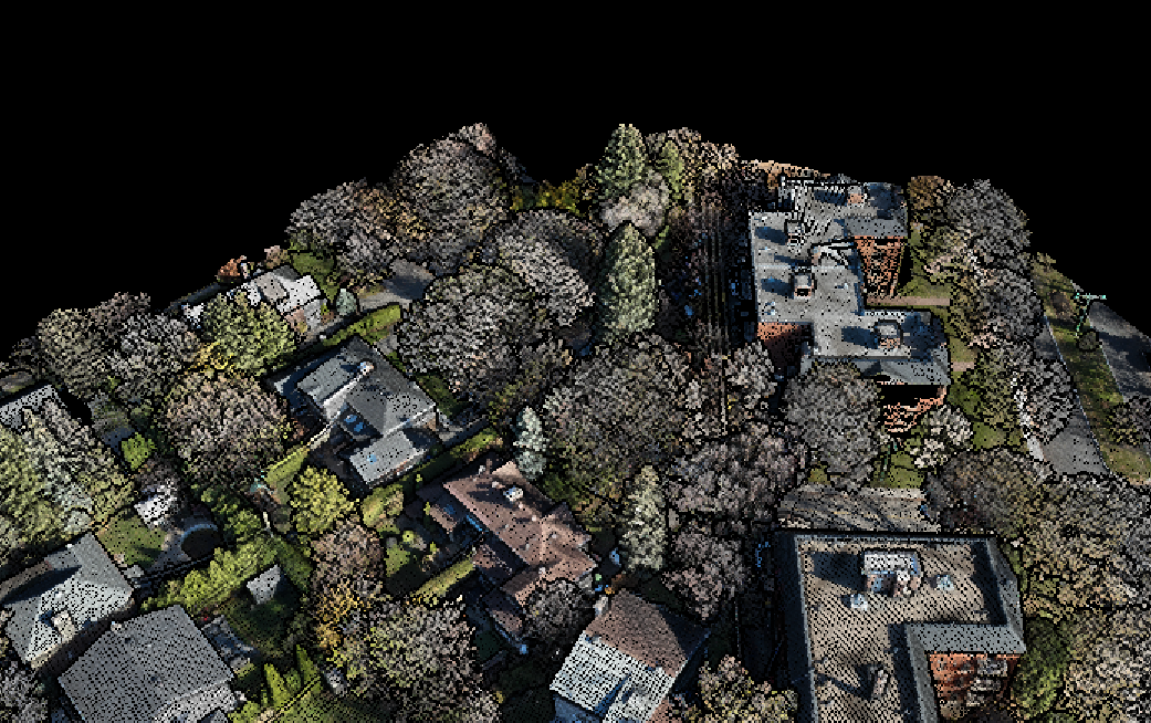
As part of a broader effort to support the renovation of a heritage-style residence in the Town of Mount Royal, our firm, Mesur, was mandated to perform a complete 3D scan of a three-story New England-style home. Given the property’s architectural significance and heritage designation, the renovation process is expected to require extensive documentation and planning.
The primary goal of the scan was to capture highly precise spatial data of both the interior and exterior of the home, allowing for the creation of detailed as-built plans and an accurate digital model of the existing conditions. Particular attention was placed on documenting the exterior materials and architectural features, ensuring that the design team could work with reliable reference information throughout the approval and renovation process. The scan will also support future landscaping and site planning, including the design of a new rear extension, by providing an accurate topographic and volumetric context of the property.
Method
To capture the full complexity of the residence and its surrounding context, our team relied on a combination of the Trimble X9 terrestrial scanner and the DJI L2 LiDAR drone—two advanced technologies known for their precision and versatility in architectural and site-scale documentation.
The Trimble X9 is a high-performance ground-based 3D laser scanner designed to capture intricate building details and accurate measurements across both interior and exterior environments. It excels in recording fine architectural geometry and textures, making it especially effective for heritage properties. Complementing this, the L2 LiDAR drone scanner—a lightweight aerial system mounted on a DJI platform—was used to scan the rooftops and broader neighbourhood context. The L2 is ideal for quickly capturing large areas with accurate topographic and volumetric data, even over irregular terrain or hard-to-reach areas.
By combining both data sets within Trimble’s processing environment, we were able to generate a dense, highly precise “supermodel” that represented the home and its surroundings at multiple scales. This allowed architects and designers to orbit around the model, visualize relationships between structures and landscape, and make well-informed decisions about where and how to expand the home in the most logical and context-sensitive way.
Conclusion :
This project reaffirmed the value of the Trimble X9 as a powerful tool for residential heritage projects requiring precise, high-fidelity documentation. While the level of detail it provides can at times exceed the practical needs—or timelines—of certain private-sector projects, especially when working within tighter budgets or with fast-moving design phases, its strengths in capturing accurate geometry and complex surfaces are undeniable.
Through this initiative, we gained a deeper understanding of how to best leverage our tools based on project scale, client expectations, and design objectives. The combination of the X9 terrestrial point cloud with supplementary LiDAR drone data allowed us to build a comprehensive model that successfully bridged micro and macro scales—providing exceptional clarity from material texture up to site-wide topography. The resulting deliverables not only elevated the quality of architectural decision-making but also reinforced our ability to tailor our workflow to match each project’s unique demands.